|
| *****SWAAG_ID***** | 575 |
| Date Entered | 03/07/2012 |
| Updated on | 29/08/2012 |
| Recorded by | Will Swales |
| Category | Vernacular Record |
| Record Type | General HER |
| Site Access | Public Access Land |
| Record Date | 03/07/2012 |
| Location | Gibbon Hill |
| Civil Parish | Grinton |
| Brit. National Grid | SE 016 959 |
| Altitude | 530m |
| Record Name | Boundary stone on Gibbon Hill |
| Record Description | GRI-21 is boundary stone number 21 of the first 21 around Grinton Parish starting from Stolerston Stile and reaching as far as Gibbon Hill. It stands on the Grinton-Bolton watershed, 400m east of the summit of Gibbon Hill, on the Grinton side of a boundary fence. Suggestions for the meanings of the inscriptions F and B are invited. |
| Image 1 ID | 3138 Click image to enlarge |
| Image 1 Description | Grinton-Bolton boundary stone at Gibbon Hill - south face | 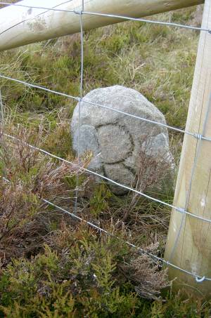 |
| Image 2 ID | 3153 Click image to enlarge |
| Image 2 Description | Grinton-Bolton boundary stone at Gibbon Hill - north face | 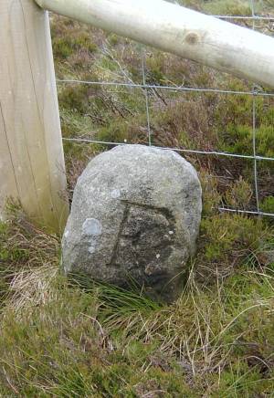 |

